Patton Creek, Rebel Branch
-
RunPatton Creek, Rebel Branch
-
ClassIV (IV+)
-
Put InOld Creek Road (off of Canyon Road)
-
Take OutHwy 31
-
Length (mi)1.8
-
Gradient (fpm)298' total, 165 fpm avg.
-
Watershed (mi2)0.4
-
Primary Gage
- None Visual
-
Indicator Gage
none
Description
Of the glorified drainage ditches I have run in the Birmingham Metropolitan area, Rebel Creek is by far the most entertaining. As I have been unable to find the actual name of this creek on any map, I named it Rebel Creek after the Mascot of the local high school. If you are able to find Rebel Creek, the first thing you will notice is how tiny its watershed is. You literally have to run this creek right after or during a heavy rain, because the bottom will drop out of it in about an hour or so. Fortunately, Birmingham seems to be blessed with an abundance of flashy storms every winter and spring, and since there is scant green space, it all ends up in the local streams via neighborhood storm drains. Rebel Creek is not, however, like paddling through an urban wasteland. It is a quite beautiful mini-gorge, with abundant limestone formations sometimes rising straight out of the water to the height of about 50 feet. The local residents have worked pretty hard to keep this place a secret, so you'll have to find it yourself.
The run starts at the confluence of two tiny streams that essentially drain neighborhoods. Just past a small bridge that goes over one of the two small streams that make up the creek, there is a gated power line cut by which you can access Rebel creek. Look for all of the rocks to be covered for an enjoyable flow. If you happen to catch this creek with high water, you better buckle your seatbelt, because it will be non-stop action. If you happen to put on it without enough water, be ready to buy a new boat after your run.
Rebel Creek is very continuous in nature, with little, if any, flatwater. Stacked between the smaller drops are five or six distinct larger drops in the ten to fifteen foot range, none of them vertical. They are pretty evenly spaced throughout the first two-thirds of the run, and are reminiscent of some of the smaller drops on Honeycomb Creek. Nothing too threatening here, as long as you aren't afraid of super tight, technical micro-creek rapids with only occasional eddies. On our run, there were at least four or five logs that came into play, although we only had to walk around one rapid because of the wood.
The first drop is one of the best, and can be recognized by a footbridge over the creek. It's a pretty straightforward boof off the left side of a large boulder. Several more good drops follow, and scouting is easy from a small paved road/sewer trunk line running parallel to the creek. Once the road disappears, you have about two thirds of the run left. The creek really begins to gorge up at this point, dropping you into a virtual wonderland. A nice three-foot boof into a ten foot runout rapid marks the beginning of this section. After this, there are two more fairly good drops interspersed with plenty of boogie water before you finally drop out into the open again, replete with the sound of traffic and the scent of exhaust...
-Shane Hulsey
Details
-
ClassIV (IV+)
-
Gradient (fpm)298' total, 165 fpm avg.
-
Length (mi)1.8
-
Watershed Size (mi2)0.4
-
Put InOld Creek Road (off of Canyon Road)
-
Take OutHwy 31
-
Shuttle
-
Water Quality
 (
2 chickens | 1 = Good, 3 = Gross)
(
2 chickens | 1 = Good, 3 = Gross)
-
Primary Gage
- None Visual
-
Indicator Gage
-
Precip. Gage
Map
Video
Photos
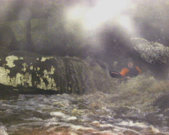
Rebel Creek. A bizarre shot (only adds to the mystery, huh?) (photo courtesy Shane Hulsey)
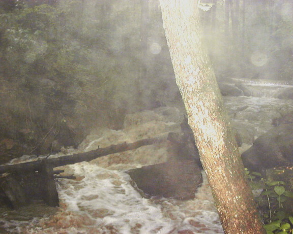
More water spots partially obscuring an poorly placed log (photo courtesy Shane Hulsey)
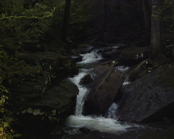
Rebel Creek scouting trip. (photo courtesy Shane Hulsey)
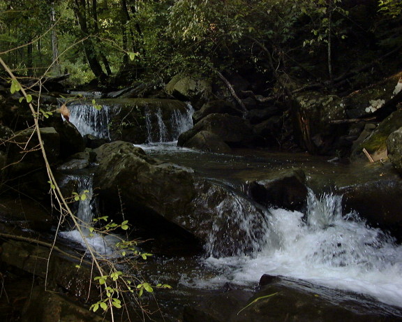
Rebel Creek drops without the runnable water. (photo courtesy Shane Hulsey)