Vestavia Branch of Little Shades Creek
-
RunVestavia Branch of Little Shades Creek
-
ClassIV (V at high water)
-
Put InShady Creek Lane off Hwy 31 in Vestavia Hills
-
Take OutJust beyond Concrete Culvert
-
Length (mi)0.26
-
Gradient (fpm)130 (0.26)
-
Watershed (mi2)0.6
-
Primary Gage
- None Visual
-
Indicator Gage
none
Description
This creek really does not have an official name. So we can call it Shady Creek. Shady Creek is really just a short, steep series of drops tucked away in a nice little neighborhood just over the mountain from downtown Birmingham. Although you could run the creek all the way to Rocky Ridge Road, you can probably live without the weak gradient and enormous piles of yard waste you'll likely encounter. That said, the takeout for Shady Creek is only 1500 feet from it's put in...but you lose over 100 feet in that short space! Needless to say, you can run this and be back at your desk before your boss gets back from his three martini lunch. Put in below the Vestavia Lake Dam at the cul-de-sac on Shady Creek Lane. The run consists of six or seven drops, each with its own small set of moves. The final slide drops about 40 feet and slams into a concrete culvert as the creek makes its way under the road. The day we ran it the water was on the low side, but even then there was a pillow you could brace against to avoid slamming the wall of the culvert. Be discreet here, as you are paddling through people's back yards the entire run. Shady Creek seems to run real often due to stormwater runoff from Vestavia Hills, but be careful - Mark Travis described this run as "the most out of control I've ever been in a boat".
Shades runs while Birmingham is getting dumped on. Too much water could make things real ugly real fast.
- Shane Hulsey
Details
-
ClassIV (V at high water)
-
Gradient (fpm)130 (0.26)
-
Length (mi)0.26
-
Watershed Size (mi2)0.6
-
Put InShady Creek Lane off Hwy 31 in Vestavia Hills
-
Take OutJust beyond Concrete Culvert
-
ShuttleN/A
-
Water Quality
 (
2 chickens | 1 = Good, 3 = Gross)
(
2 chickens | 1 = Good, 3 = Gross)
-
Primary Gage
- None Visual
-
Indicator Gage
-
Precip. Gage
Map
Video
Photos
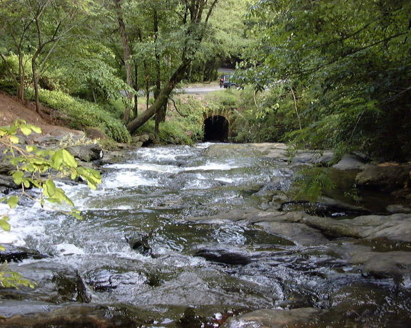
A view down Shades Creek at low water (photo courtesy Shane Hulsey)
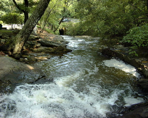
Another... (photo courtesy Shane Hulsey)
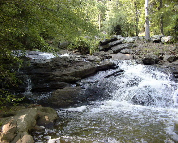
A Shades Creek drop at low water (photo courtesy Shane Hulsey)