Jones Creek
-
RunJones Creek
-
ClassV+
-
Put InRt. 71
-
Take OutCamp Jackson
-
Length (mi)5.35 to lake
-
Gradient (fpm)50, 30 (to bridge @ 1.85 mi), 420, 120, 40, 25 (0.5)
-
Watershed (mi2)41.7
-
Primary Gage
- Put-in Bridge **see below 6" **
-
Indicator Gage
Description
Actual put-in is on Bryant Creek. That mile below the old bridge at mile 1.85 is indeed 420'/mile. Solid V with V+. Big drops with undercuts on almost every drop make this a potentially dangerous run. The first big drop can be scouted/portaged on the left down a goat trail.
Mike Huff offers these words: Jones is a great run but it is what most people refer to as "dirty creeking." The rapids aren't all that bad as far as steep creeking goes but they are placed one after another after another with each one having it's own set of consequences. The pin potential is very high and broaching in a slot is not very difficult to do. In some ways the run is more difficult at low water but high water creates it's own set of problems. Overall the run is not full of vertical drops (except the falls). All the altitude you lose comes from running down the side of the mountain nonstop. Downstream visibility is at a minimum most of the time and running slots blind is pretty much the norm. Most of the narrows section is a constant horizon line. Oh yea, the lake paddle SUCKS, but not as bad as Flat Rock. (ah, Flat Rock / Coon, the standard by which heinous is measured in so many ways...I earned -10 Greg Lawrence brownie points there with just a teensy mis-estimation of water level at the put-in - MD')
Daniel Talley: I haven't done Overflow or Cullasaja, but it does compare to West Prong trailhead section in regard to steep gradient and the non-stop sort of sensation. Yet, West Prong is sort of forgiving in its own way with all those smooth and polished boulders.
I like the "dirty creekin" term. These boulders can be rough at times and there are some real scary places on there for sure. Taking the wrong slots could be hazardous to say the least. However steep Jones may be though, for the most part there will be a pool or an eddy below the drop to take a breath. On the West Prong you really have to hunt for them sometimes.
It really doesn't compare to Linville Gorge. Jones is much smaller and shorter. Maybe if you take that section below cathedral and made it a lot steeper. I wish Jones was a little longer actually, but for that you have to go father north up sand mountain which equals hellacious lake paddles!
Sort of similar to the Green, aside from gorilla and the slide drops.
The gradient is compiled a bit strangely here. The creek drops off at the old bridge 1.85 miles below the put-in, so the gradient is in increments of 1, 0.85, 1, 1, 1 and 0.5 miles.
** Unfortunately, a new bridge highway bridge at the put-in may be rendering these old levels meaningless in summer 2004. If the put-in gage is still OK, then some consider 7" as medium, 10-12" optimum, and 14" as the beginning of high, others like it above 12" or more. When Town is 350 Jones may be a scrapy minimum. If it looks like you can just scrape over the drop at the put-in, you will have good water. 500 on Town usually means good water. Above 750, Jones starts to get high.
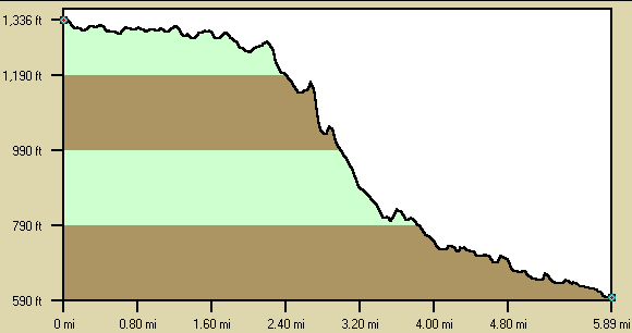
Below is a profile of the creek gradient. These data are not as accurate as the gradient field above but do give a graphical feel for how the gradient is distributed.
Details
-
ClassV+
-
Gradient (fpm)50, 30 (to bridge @ 1.85 mi), 420, 120, 40, 25 (0.5)
-
Length (mi)5.35 to lake
-
Watershed Size (mi2)41.7
-
Put InRt. 71
-
Take OutCamp Jackson
-
ShuttleRt 71/ Hwy 35/ Camp Jackson
-
Water Quality
 (
2 chickens | 1 = Good, 3 = Gross)
(
2 chickens | 1 = Good, 3 = Gross)
-
Primary Gage
- Put-in Bridge **see below 6" **
-
Indicator Gage
-
Precip. Gage
Map
Video
Photos
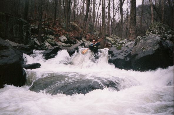
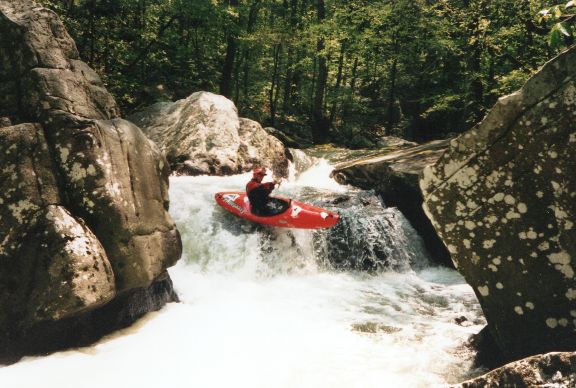
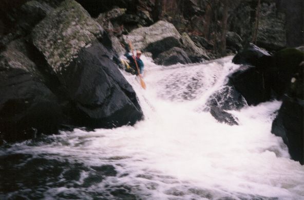
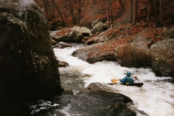
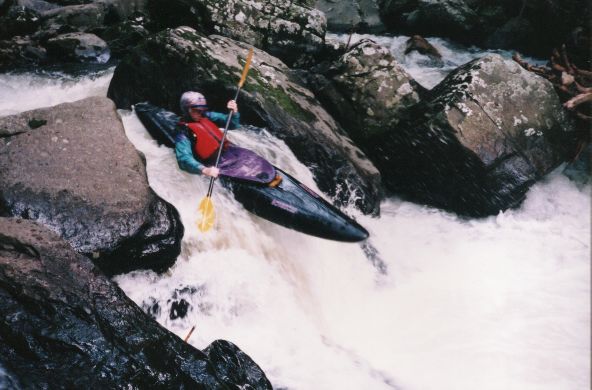
Brad Hinds on his 4th run down Jones in a boat called 'Ruby' (photo coutesy Pierce Harp)
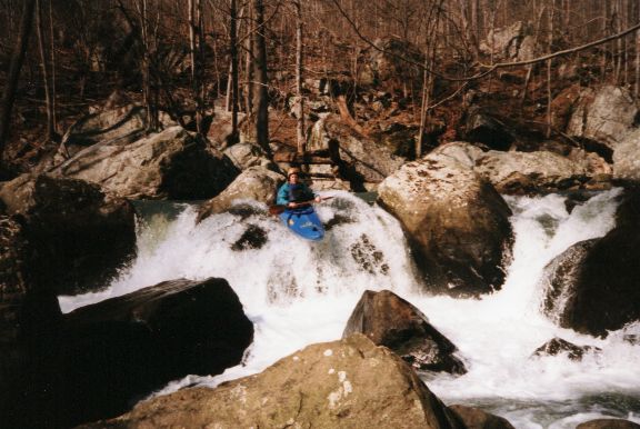
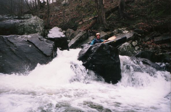
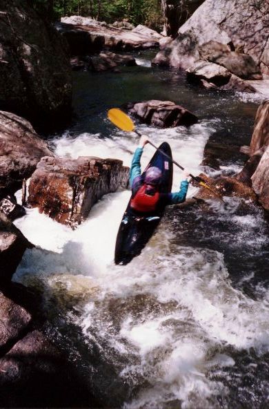
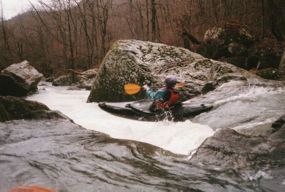
Daniel Talley at casey jones (photo courtesy Daniel Talley)
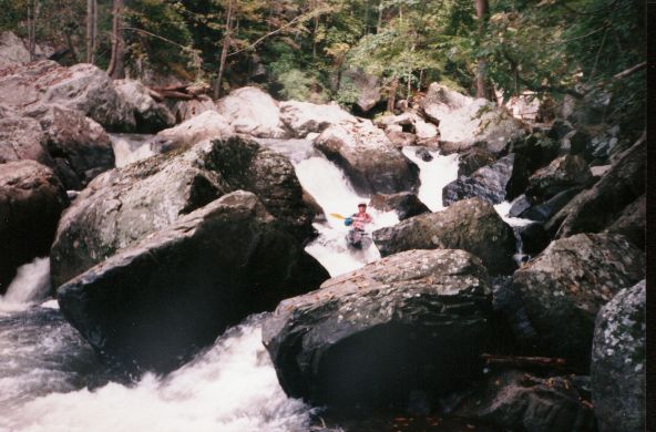
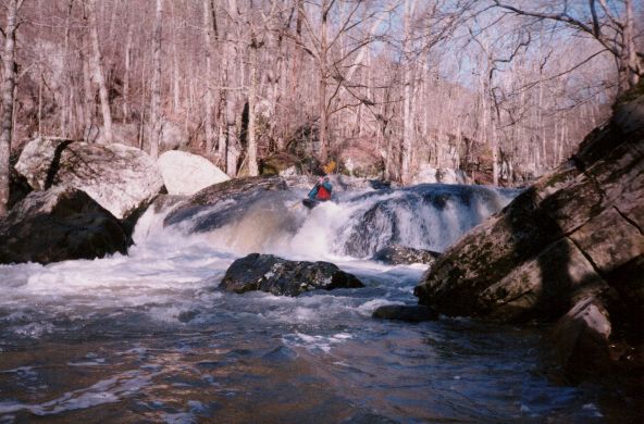
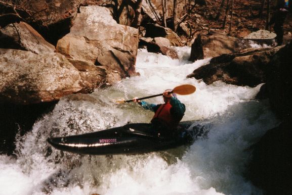
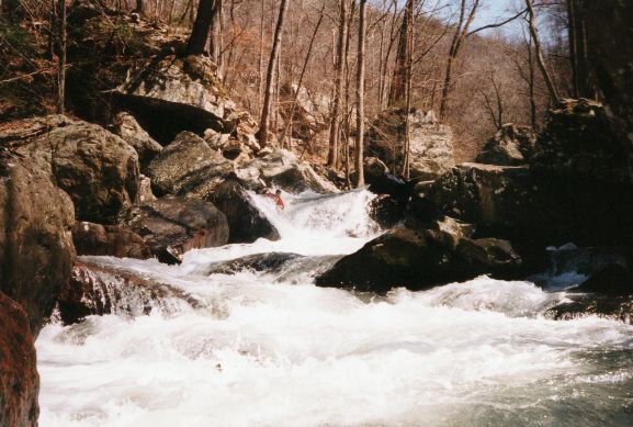
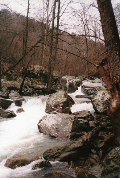
Howard Tidwell at 3rd drop of the dog (photo courtesy Daniel Talley)
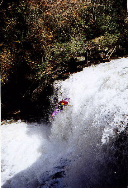
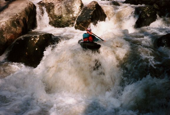
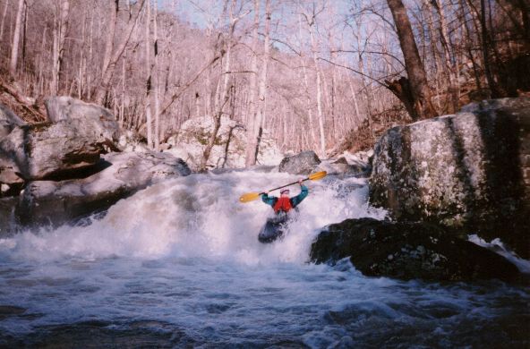
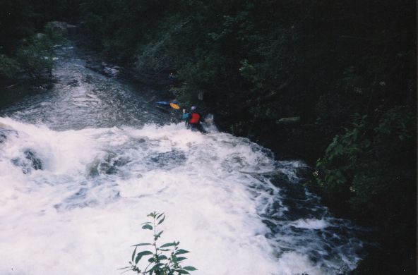
Howard at the first falls (photo courtesy Daniel Talley)
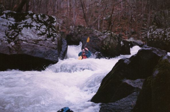
Ross Whitaker at 3rd drop of the dog (photo courtesy Daniel Talley)
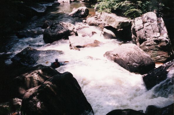
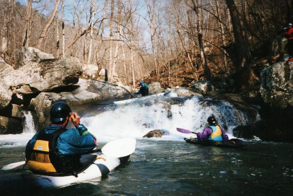
Tony Robinson points to the line in the rapids above casey jones (photo courtesy Daniel Talley)
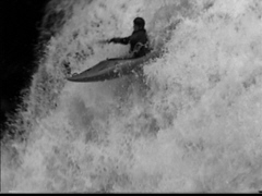
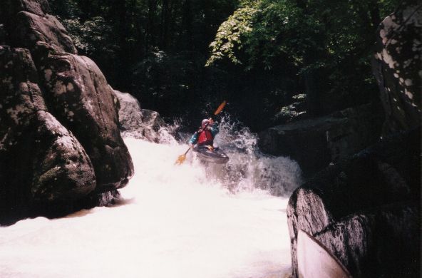
Sloan on a tight drop near the beginning of the run, "Welcome to Jones" (photo courtesy Sloan Bryan)
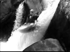
Five to six foot vertical near beginning of Jones, around six to seven inches (photo courtesy Sloan Bryan)
Sloan at top of Ricochet (photo courtesy Sloan Bryan)

Sloan on Ricochet, around 12- 14 inches (photo courtesy Sloan Bryan)
Ron in middle of Ricochet, low water - six to seven inches (photo courtesy Sloan Bryan)
Ron on Ricochet near the bottom of the drop, around fourteen inches (photo courtesy Sloan Bryan)
Sloan stuck at bottom of ricochet, around six to seven inches, same part of drop (photo courtesy Sloan Bryan)
Ron on drop after Ricochet, we call this Gonzo Falls(long story). See the submerged rock to his left? This is what you've gotta miss, it's not hard (...)
Same drop around six to seven inches, you can see the rock (photo courtesy Sloan Bryan)
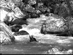
Ron exiting a drop in middle of Jones steep section (photo courtesy Sloan Bryan)
Dustin on Hatchet, this is where Jones gets real interesting, Funnel is just downstream (photo courtesy Sloan Bryan)
Ron on Hatchet, ten to twelve inches (photo courtesy Sloan Bryan)
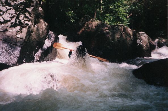
Ron on Funnel, a hard move at any level, just before Eye of the needle which leads into Bowdown. These three are really one long Class V with many places (...)
Another angle of Funnel, Ron (photo courtesy Sloan Bryan)

A Vest on Eye of the needle. The log was removed by Tony Robinson of Knoxville a few years ago, made the move a lot more fun, easier. Tony also made th (...)
Sloan on Bowdown around six to seven inches, riding high right in the "groove tube". Water has eroded a groove in this rock, if you don't boof into the g (...)
-? on Bowdown, good level, ten inches?
Exiting bowdown (photo courtesy Sloan Bryan)
Ron on approach to falls, eight inches? (photo courtesy Sloan Bryan)

One of the Vest's on the falls good line , seven inches? (photo courtesy Sloan Bryan)
We call this The Gulley it is just before Casey Jones. Eddy on the right at the end of it to avoid a slot on river left which is undercut on the left (p (...)
Ron at beginning of #2 (photo courtesy Sloan Bryan)
Sloan backendering out of slot(#4) (photo courtesy Sloan Bryan)
Even c-boaters can run Jones (photo courtesy Sloan Bryan)
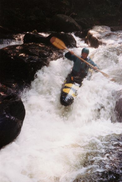
Ron on #8 with better h20 (photo courtesy Sloan Bryan)
Ron on a small drop near the end of the steep stuff (photo courtesy Sloan Bryan)