Chestnut Creek US 31 to Mtn Creek Ford
-
RunChestnut Creek
-
ClassII
-
Put InUS 31
-
Take OutMtn Creek Ford or Lake Jordan**
-
Length (mi)6.1 to Mtn. Creek, 4.5 from Mtn Crk to Lake Jordan
-
Gradient (fpm)30, 5, 5, 10, 10, 20 (1.1) MtnCr, 20, 10, 20, 25, 5 (0.5)
-
Watershed (mi2)38.8
-
Primary Gage
- None Visual(see pictures also)
-
Indicator Gage
none
Description
Chestnut Creek begins in the Clanton area and flows south to Lake Jordan. When the creek reaches the US-31 bridge in Verbena the gradient begins to increase as it drops into the Coosa Valley area of upper Lake Jordan. I did not see a gage on this bridge but if the first rapid looks good then the rest of the run will be nice. The river starts off with a nice series of waves and holes in the Class II variety. The action is pretty good for the next 1/4 mile. The creek then levels out for a short distance When you see a newer brick house on the right prepare for the next series of drops. These will be some of the best on the creek. Look for a nice 360 hole on the way down. The rest of the run is intermittent moving flat water and class I-II waves. It has a few nice long wave train sections. When you get to a large clear cut area look for a tributary on the right. This will be the first significant tributary and it is called Mountain Creek. Take out just upstream of Mountain Creek and walk 100 yards to the ford. There may be some rapids downstream but probably not worth a long paddle across Lake Jordan! [possibly only 0.5 to 0.75 miles -editor]
The total run is approximately 5 miles. I ran it solo in about 2 hours. Some small play. All the flat water moves pretty quick. It has a small watershed. I think the time window is about 2 days. We had about 1" of rain last night and that was plenty. It could be run a good bit lower but I would not want to. It would be a good beginner run. Good eddy lines, waves, a few holes but not intimidating. I would run it in stealth mode as the local property owners are as proud of their land as they are their fighting roosters. Plenty of posted signs.
To find the take out follow US 31 south from Verbena. After approx. 2 miles turn left on county road 23. Follow county 23 and take the first paved road on the left (You will see a sign for New Harmony Church). Take the first dirt road on the immediate left. Follow the dirt road to the ford staying right. [you can see this pretty well on the 1:24,000 topo]. Park near the ford. Chestnut Creek meets Mountain Creek (the creek you ford) about 150 yards downstream. You can paddle/walk up Mountain Creek to your vehicle. - Bill Patterson
Brad Thompson has an update to the directions: Mountain Creek take out is off of HWY 31 South at Chilton County Road 524. You travel this road to an intersection where you turn left and proceed to ford. The Mountain Creek ford is a good take out.
[The stream continues on after Mountain Creek for another 4.5 miles and has a little more gradient and water over that stretch. You would have to take out on Lake Jordan by either paddling across the river to possible rural road access, or 2.6 miles upriver to route 22. It is significant to note that the lake pool comes up about 1.5 miles up the creek, so the flatwater paddle would not be short. I don't know if either of these are sane options, but we do lake take-outs up north, so who knows?]
Details
-
ClassII
-
Gradient (fpm)30, 5, 5, 10, 10, 20 (1.1) MtnCr, 20, 10, 20, 25, 5 (0.5)
-
Length (mi)6.1 to Mtn. Creek, 4.5 from Mtn Crk to Lake Jordan
-
Watershed Size (mi2)38.8
-
Put InUS 31
-
Take OutMtn Creek Ford or Lake Jordan**
-
Shuttle31 / CR23 / see text
-
Water Quality
 (
2 chickens | 1 = Good, 3 = Gross)
(
2 chickens | 1 = Good, 3 = Gross)
-
Primary Gage
- None Visual(see pictures also)
-
Indicator Gage
-
Precip. Gage
Map
Video
Photos
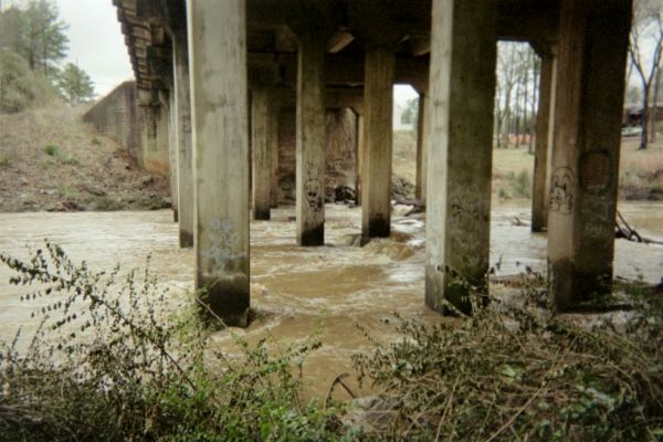
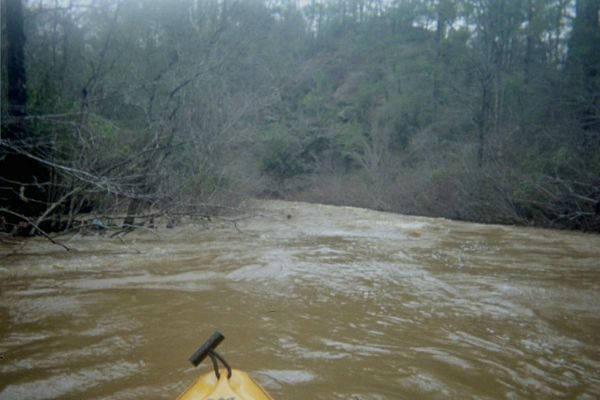
The put-in at a good level (see trip report). (photo courtesy Brad Thompson)
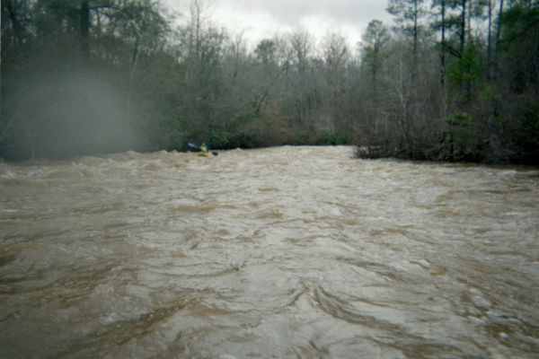
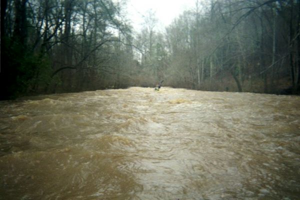
Charlotte Thompson on Chestnut Creek 2/6/04. (photo courtesy Brad Thompson)
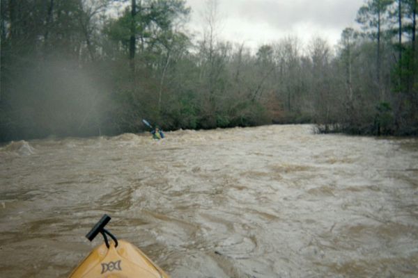
Charlotte Thompson (photo courtesy Brad Thompson)
Charlotte Thompson (photo courtesy Brad Thompson)
(photo courtesy Brad Thompson)
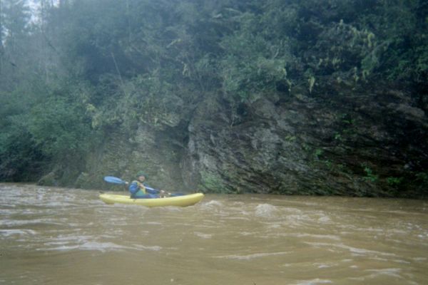
Charlotte Thompson. (photo courtesy Brad Thompson)
Trip Reports
Chestnut Creek
Written by Brad Thompson
After learning of Chestnut Creek on the AL Whitewater site, I decided to see it for myself. Waited for about 1.5 to 2 inches of rain in the north Autauga County area and we decided to go. We rode two SOTs. Charlotte Thompson, my wife, accompanied in true February furvor.
The explaination by Mr. Patterson on the site is mostly accurate, the only differences we noted were the Mountain Creek take out is off of HWY 31 South at Chilton County Road 529. You travel this road to an intersection where you turn left and proceed to ford. The Mountain Creek ford is a good take out. (We were on no paved roads after turning off hwy 31.)
The run was also well described by Mr. Patterson We found a good rapid at the put-in and a couple of surfable waves before the good rapid just below the red brick house. This rapid did cause Charlotte to swim, as she was not paddling very aggressively and was swallowed by the last wave at the bottom. There were two notable trees that were impeding the flow and safe passage at this level. The creek is relatively narrow and had swift current for the entire trip.
Of notable mention the creek divides into two almost even flows around an island at about the 2/3rds point in the trip. The route to the left had a tree blocade and the route around the right was navagable and contained some standing waves. GO RIGHT.
We had a lot of fun on Chestnut Creek. The level is best described at the north side of the HWY 31 bridge as flow running over (1"-2") over the base of the pylons in the middle of the bridge and not flowing over the base of the pylon nearest the bank (see picture). High water could definetly be dangerous as there would be possibly no eddies, and sweepers galore. Our trip took about 2.5 hours with the swim and paddle recovery, two tree ordeals, a little surfin', and a coke and cracker lunch.