Mulberry Fork of the Warrior River Rt. 67 to Rt. 278
-
RunMulberry Fork of the Warrior River
-
ClassII/II+
-
Put InSR 67
-
Take OutSR 278
-
Length (mi)5.0
-
Gradient (fpm)20, 20, 20, 20, 20
-
Watershed (mi2)41
-
Primary Gage
- StreamBeam Mulberry 2.0'
-
Indicator Gage
none
Description
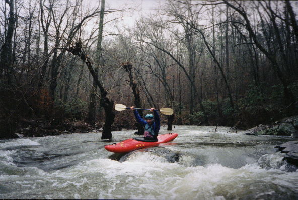
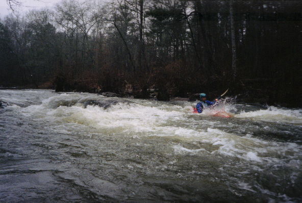
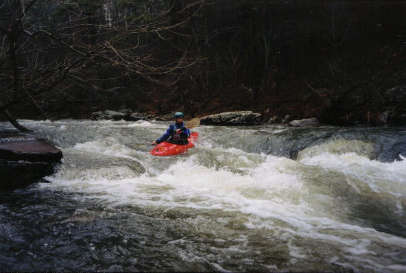
The 'Upper, Upper' (Upper, Upper Upper?) Mulberry is a delightful class I, II, and II+ run. The run begins with class I shoals and simple rapids, and ends up with a few nice II+ rapids. Most everything is a straight shot. As of 2/13/2001, there was one log jam that could barely be avoided and one or two other logs that you could go over with the Garden City gage around 7.4' (~3.5' on the StreamBeam / US31 gauge). This run would be great as an introduction to whitewater or for those seeking a mellower time. I think it is more interesting than the Upper Mulberry. It is easier than the Locust but it has plenty of eddies to catch. The water moves throughout the run, the longest pool is only a few hundred yards long. Several easy, fun front surfing waves are available, and a couple holes could be surfed.
Around 2.0' on the StreamBeam / US31 bridge gauge is likely the minimum - 2.7'+ would be better. This section will have around 1/4-1/3 of the flow of the river in Garden City, and other tributaries could be significantly higher while this section remains low. (Flow information converted from old USGS info below).
The best place to park at Rt. 67 is the downstream river right side. A wide shoulder in front of a shop has a friendly owner. Two people have gotten hurt using this put-in either by stepping on a wooden stub or falling onto a stump. It is a steep rip-rap bank as I remember, so take your time and be careful.
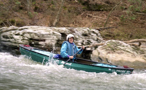
This run is relatively 'new' to the current Huntsville crowd but has been run many times over the last decades. Kevin Baker used to put in a tandem canoe in various seasons of the year and run all the way to Garden City. The run is around 20 miles, and he says sometimes they had to take out in the dark.
Old flow information related to discontinued USGS gauge:
6.0' is probably minimum, but take a look at the put-in. 6.7'+ is probably even better. We ran it as the gage went from 6.7 up to 7.8 or so. The reading at Garden City has other tributaries such as the Duck adding their flow, so this section should have about 1/3 or 1/4 the flow at G.C. Check to see if the other tribs are disproportionally high.
Details
-
ClassII/II+
-
Gradient (fpm)20, 20, 20, 20, 20
-
Length (mi)5.0
-
Watershed Size (mi2)41
-
Put InSR 67
-
Take OutSR 278
-
Shuttle67 / 231 / 278 or 67 / 1748 / 1742 / 278
-
Water Quality
 (
2 chickens | 1 = Good, 3 = Gross)
-
Primary Gage
- StreamBeam Mulberry 2.0'
-
Indicator Gage
-
Precip. Gage
Map
Trip Reports
A Not-So-Familiar Mulberry Fork
February 24, 2001
Written by Murray Carroll
Several years ago I talked with a gentleman who related a story about a great float fishing trip that he had been doing. He told me about a whitewater stretch of the Mulberry Fork River which lies well above both the standard Mulberry Fork run and the "Upper" Mulberry Fork stretch. He and his partner, neither of which are whitewater paddlers, paddled and fished this segment of the Mulberry several times at low water until he broached his canoe under a tree and decided that this was just a little more river than he wanted to canoe. I filed the idea of running this portion of the Mulberry away in the back of my mind after visiting the put-in twice, each time the water was too low to run.
In the meantime, Mark D' began the worthwhile project of running, photographing, mapping and publishing every possible whitewater stretch in the state of Alabama. Well, my procrastination led to Mark being the first HCC paddler to run this segment of the Mulberry Fork. My hat is off to Mister D'Agostino; his description of the run and the water level requirements were right on the money.
The weather forcast for Saturday, February 24 didn't sound too encouraging. The Weather Channel was predicting high winds and afternoon showers, but the temperature was to approach the mid 60's. The water level seemed about perfect, 5.5' on the USGS Mulberry Fork, Garden City gage. We decided to try and beat any rain so Bob and Brenda Barnett, Si Klueger, Curt Ruffing, Kay and I left Hardy's at 8:30 a.m. A short drive to just above Rainbow Crossing led us to the put-in on Route 67. Parking is ample at the put-in; there is a wide paved shoulder on the downstream-river right side of the bridge. The gentleman who owns the property at this location said we were welcome to park there anytime. The shuttle run has to be one of the quickest of any run in the state; I believe that it may be shorter than any of the convienent shuttles on the nearby Locust Fork.
Bob, Si and I ran shuttle while Curt, Brenda and Kay took the boats down to the river. Curt managed to step on a stob (that's my west Tennessee lingo for a sharpened sapling that sticks up from the ground) and puncture his paddling shoe and a good portion of his foot. By the time shuttle was complete, the girls had emptied the blood out of his shoe, treated the wound and applied bandages. Curt decided that a little punji stick puncture wasn't going to ruin a good day's paddling, so off we go with only Mark's description to guide us.
I won't go into a blow-by-blow description of the trip, but it was a pure class I-II delight. The river flows right along with no really dead pools. As you proceed down the river, it progresses from Class I shoals to Class II drops. Toward the end, the run again backs off to Class I. This stream is a pure delight. It is what most beginning paddlers look for and never find; a non-intimidating whitewater run that can both build confidence and provide a playground for newly acquired skills.
Again, many thanks to Mark D' for documenting this stretch of river. By the way Mark, is this the Upper-Upper Mulberry or the Upper-Upper-Upper Mulberry?


