Brushy Creek
-
RunBrushy Creek
-
ClassI
-
Put InBrushy Lake
-
Take OutF.S. Road 255
-
Length (mi)10
-
Gradient (fpm)6'/mile
-
Watershed (mi2)19.5
-
Primary Gage
-
Indicator Gage
- Sipsey Fork near Grayson 180 cfs? (semi-guess)
Description
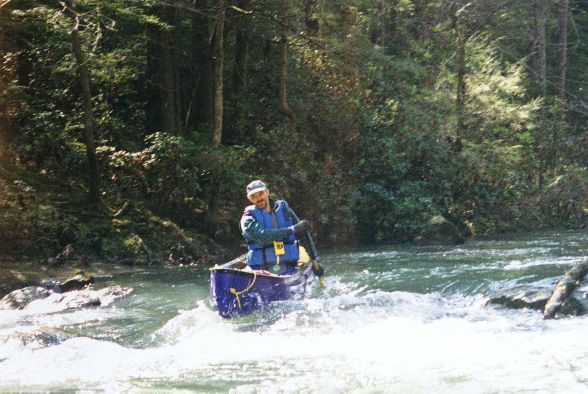
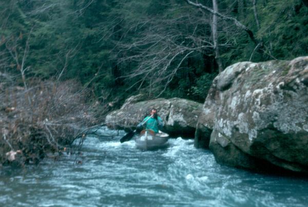
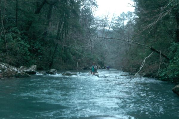
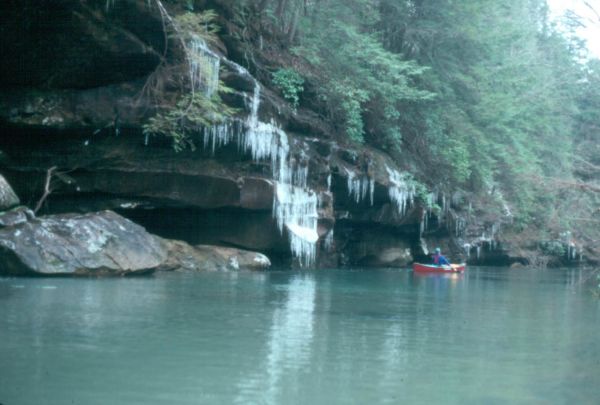
Brushy Creek is a Class I (II) creek located entirely within the Bankhead National Forest in north Alabama. Brushy is the twin sister of the much better known Sipsey River (West Fork of the Sipsey). The big difference is that the Sipsey has achieved National Wild and Scenic status and Brushy is not listed. The trip down Brushy is as scenic as the Sipsey and features steep canyon walls and several waterfalls on small tributary streams. The canoeing season is usually during the winter and early spring.
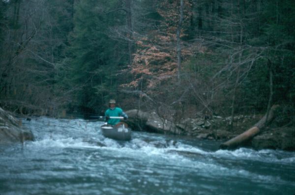
The put-in is at Brushy Lake; park at the picnic area (a fee is charged by the National Forest Service), canoe across the lake and take-out on the right side of the dam. The dam portage is fairly easy, but you have to lift your canoes over a fence and down a rocky hill. Generally, if the first shoal below the dam is runnable, there will be enough water to float the creek. Here's a rundown on major features:
Mile 1 - small feeder stream on west has a beautiful waterfall about 1/4 mile upstream.
Mile 2 - Beech Creek enters on river right.
Mile 2.8 - "The String of Beads"; a series of rocks strewn along the left shore constricting the flow of the creek. Coal Mine Branch enters on river left. The branch has a shallow, settler-dug coal mine in the bluff lines. There is beautiful waterfall at the head of the branch.
Mile 4.3 - Collier Creek enters on river right
Mile 6 - Sougahoagdee Creek enters on river right. Be sure to stop here and go up the creek to one of the most magnificent waterfalls in the forest. It isn't far and you won't want to miss this sight!
Mile 7 - Rush Creek enters on river left. I have heard that Rush is a great run in high water, but haven't tried it yet.
Mile 7.5 - A small waterfalls where a creek enters on river left.
Mile 8 - Take-out at Hickory Grove Road (FS Road 255).
Information for this trip taken from an article in the "Bankhead Monitor", "Canoeing Brushy Creek".
At 600 cfs on the Sipsey gauge, as of May 5, 2009 there were several strainers that required maneuvering and a couple that were real hazards with a fast flow.
At flows higer than 1100 cfs on the Sipsey gauge, the low bridge at the takeout could become a serious hazard . The fast moving water is right at the bridge level and the hydraullics are squirrelly around the bridge.
The shuttle for Brushy can be run to the east or west of the creek. The west route is Mt Olive Rd to CR 63 (by Grayson) to Hickory Grove Rd. The last turn is at a small church in a clearing. This route is longer and slower, but the roads are much better after heavy rain (not as muddy). The faster route to the east is just Mt Olive Rd to Hickory Grove. Mt Olive Rd abruptly turns south at a triangular shaped intersection just over a mile east of Brushy Lake. There is some parking on both sides at the takeout bridge. The south side (river right) has a little more room for turning around.
Details
-
ClassI
-
Gradient (fpm)6'/mile
-
Length (mi)10
-
Watershed Size (mi2)19.5
-
Put InBrushy Lake
-
Take OutF.S. Road 255
-
ShuttleFR245-Mt. Olive / SR33 / CR76 / CR63 / ? - FR255
-
Water Quality
 (
1 chicken | 1 = Good, 3 = Gross)
(
1 chicken | 1 = Good, 3 = Gross)
-
Primary Gage
-
Indicator Gage
- Sipsey Fork near Grayson 180 cfs? (semi-guess)
-
Precip. Gage
Map
Video
Photos

Trip Reports
Brushy Creek
March 19, 1994
Written by Murray Carroll
When Bob Barnett announced at the club meeting that he was leading a trip to Brushy Creek on Saturday it sounded interesting; besides I had never heard of Brushy Creek. Bob explained the Brushy Creek is in the Bankhead National Forest, a short drive west of Hartselle and that it flows parallel to the much better known Sipsey River, emptying into Smith Lake. What Bob didn’t tell me was that this war, a narrow, bluff lined class I/II stream with outstanding scenery. What a find! I've lived here 11 years and paddled a lot for the past three years and I’ve never beard the name of this great little creek. It’s amazing how some things of great value wait a long time to be discovered.
The trip starts with a short paddle across Brushy Lake (picnic grounds, restrooms, and a parking lot; great put-in!), then a class IV/V portage to the base of the pour-over dam structure. Once you’re in the creek itself you have embarked on a ten mile wilderness run; no people, no roads - nothing except the constantly moving creek and truly unique scenery. We ran the creek at low level and it was scratchy at some shoals (it had not rained for 1 1/2 weeks). Bob related that with 12” more water all the shoals were runnable without scraping. With higher water an alternate put-in can be made at the juncture of Beech Creek and F. S. Road 245. Beech intersects Brushy Creek a few miles below the put-in. From Bobs description, Beech Creek has a little greater difficulty level that the upper portions of Brushy. The take-out was at the low water bridge crossing F.S. Road 255, a really easy take-out with parallel parking along a gravel road. Below this take-out is another 10 miles of moving water and 5 miles in back waters of Smith Lake. Should you elect to do that section, the take-out would be on U.S. Hwy 278.
We had a total of 10 canoes (where were the kayaks?) on the trip. Club members on the creek were Chuck and Sharon Kittrell, Charlie, Cathy and C.B. Stotts, Murray and Kay Carroll, Chris Parker, Bob Barnett (trip leader), Don Gamble (Bob's able assistant trip leader) and Si Klueger who ran sweep. Several of Bob's friends also made the trip.
Many thanks to Bob and Don for showing us the "undiscovered” creek and the surrounding countryside.
I’ll be back, for sure!!