Perkins Creek
-
RunPerkins Creek
-
ClassII/III
-
Put InCranford Rd or Mount Oak Rd
-
Take OutMatt Morrow Rd.
-
Length (mi)2.2 (1.6 / 0.6)
-
Gradient (fpm)30, 20 (0.6), 50 (0.6)
-
Watershed (mi2)5.6
-
Primary Gage
- Take-out Bridge 1.0' ideal, 1.5' high
-
Indicator Gage
- StreamBeam Mulberry 5.0'?
Description
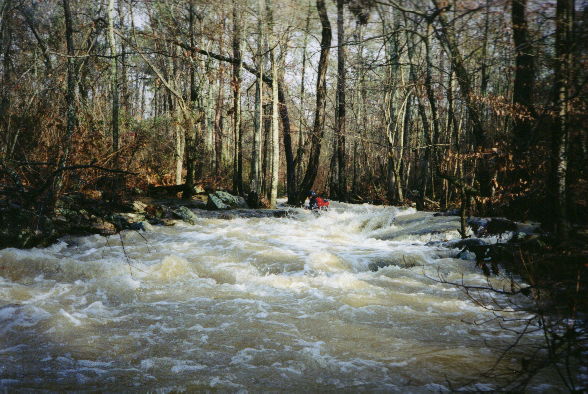
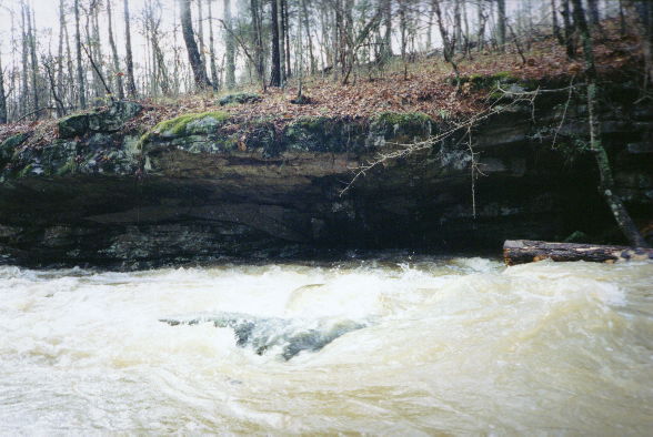
My inclusion of Perkins creek ponts out the all-inclusive goals of this guide. This is because Perkins is not recommended from the first bridge listed. But there are rapids. Unfortunately the portages are numerous and heinously infested with briars, logs, and cattle fences. It would be better to put in at Mount Oak Rd but it too has a few portages to contend with. The run from Mount Oak is OK, especially if a few logs were removed. It is nice, easy II with a touch of II+/III-. The upper stretch is a briar infested, electrical fence sporting, log jammed abonimation that would still be hardly worth it if all the deadfall was gone. A few cute rapids with one high water undercut cliff. Micro squared at the top. See the pictures and you'll see what I mean.
This run could easily be combined with a run on Mill Pond/Cotaco creek.
The run drops 30' in 1st mile, 20' in next 0.6 to bridge, then about 50' in last 0.6 mile to Matt Morrow Rd. Bridge.
Details
-
ClassII/III
-
Gradient (fpm)30, 20 (0.6), 50 (0.6)
-
Length (mi)2.2 (1.6 / 0.6)
-
Watershed Size (mi2)5.6
-
Put InCranford Rd or Mount Oak Rd
-
Take OutMatt Morrow Rd.
-
ShuttleCranford or Mount Oak / Ruth / Matt Morrow
-
Water Quality
 (
2 chickens | 1 = Good, 3 = Gross)
(
2 chickens | 1 = Good, 3 = Gross)
-
Primary Gage
- Take-out Bridge 1.0' ideal, 1.5' high
-
Indicator Gage
- StreamBeam Mulberry 5.0'?
-
Precip. Gage
Map
Video
Photos