Cahaba River Lovick to Grants Mill
-
RunCahaba River
-
ClassI/II (III)
-
Put InHwy 78 / Lovick Bridge
-
Take OutCR143 / Grants Mill Rd.
-
Length (mi)5.9
-
Gradient (fpm)~10'/mile (roughly)
-
Watershed (mi2)114
-
Primary Gage
-
Indicator Gage
none
Description
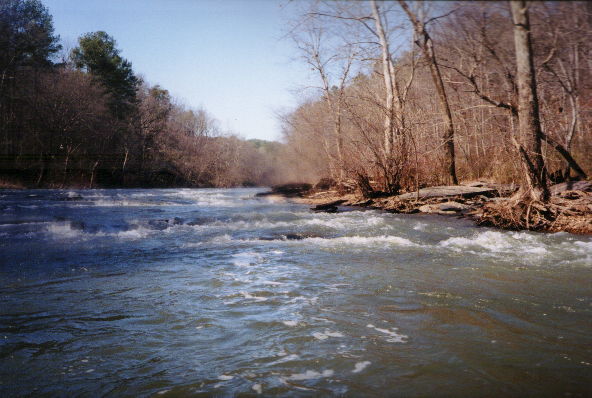
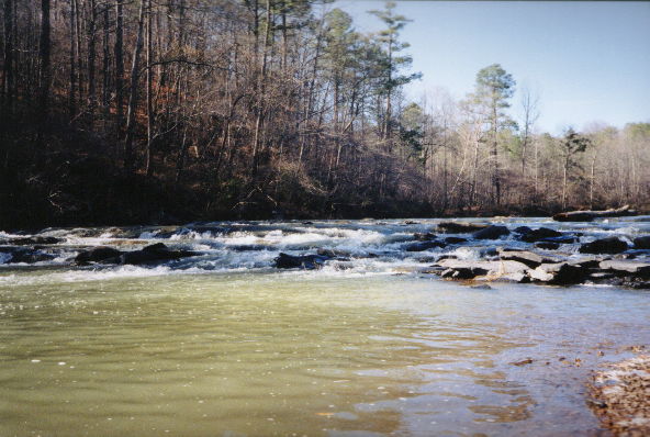
There are a few drops on this section. It's really beautiful, and could approach class 3 at higher levels. There are maybe 4 drops (all easy for the non-beginner) which are visually impressive to the beginner, and could be tricky at higher levels. The first one is real straightforward, the second definitely good, at a sharp left hand turn (it looks like a boot on the topo.). The third drop, after another left turn, is really good. It heads straight down towards really high bluffs (perhaps 100 or more feet). The last rapid is maybe 100 yards before the takeout and is about a 5 foot drop. Very pretty. The run is not hard by III/IV boater standards, but tricky perhaps. A good beginner run. I would do it at maybe 100 cfs or more. This run may be a viable option even if the Mulberry is too low. (Still, not a TRUE whitewater boater's run) Good for the adventurous recreational canoeist - Shane Hulsey
On 7/5/03, my wife and I put in on the Cahaba at Lovick Bridge, Hwy 78, near Leeds. About half-way to Grant’s Mill, a tree blocked nearly 80% of the river for canoeing purposes. In the 20% that was open, we noticed a cable that came from the land across the water to the tree. Apparently, when the tree came down, it brought the cable nearly to the water level. The cable is about 2’ above the water (water level seemed to be about normal) and in a perfect place to hurt a canoeist. It would just miss the canoe and strike a person in the chest or neck area – a very dangerous situation. If a canoeist came through this area at dusk, they might not see the cable until it was too late.
This was our first trip on the Cahaba and we went from Lovick’s Bridge to the 280 bridge. It was a great trip, even with a lot of trees down in the river – only one made us work really hard to get past. - Hugh J. Quinn
* for a minimum run. This is a reasonable run even with little water. There is a lot of flatwater. 200 is quite low, 400-600 would be better.
Details
-
ClassI/II (III)
-
Gradient (fpm)~10'/mile (roughly)
-
Length (mi)5.9
-
Watershed Size (mi2)114
-
Put InHwy 78 / Lovick Bridge
-
Take OutCR143 / Grants Mill Rd.
-
Shuttle78 / 20 / 459 / Grants Mill
-
Water Quality
 (
3 chickens | 1 = Good, 3 = Gross)
(
3 chickens | 1 = Good, 3 = Gross)
-
Primary Gage
-
Indicator Gage
-
Precip. Gage
Map
Video
Photos

The first rapid on the bend to the left. Low water level (~200 cfs at Mountain Brook).
Another wide rapid with a nice camera water drop. Low water level (~200 cfs at Mountain Brook).
Send water! Low water level (~200 cfs at Mountain Brook).
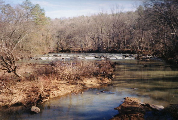
The last rapid from a distance. Low water level (~200 cfs at Mountain Brook).