Mulberry Fork of the Warrior River Hwy 278 to CR10 (many others)
-
RunMulberry Fork of the Warrior River
-
ClassI (II)
-
Put InHwy 278 (or various)
-
Take OutCR10 (or various)
-
Length (mi)22.4 miles
-
Gradient (fpm)~8'/mile
-
Watershed (mi2)67.3
-
Primary Gage
- StreamBeam Mulberry 1.5'
-
Indicator Gage
none
Description
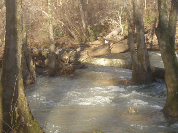
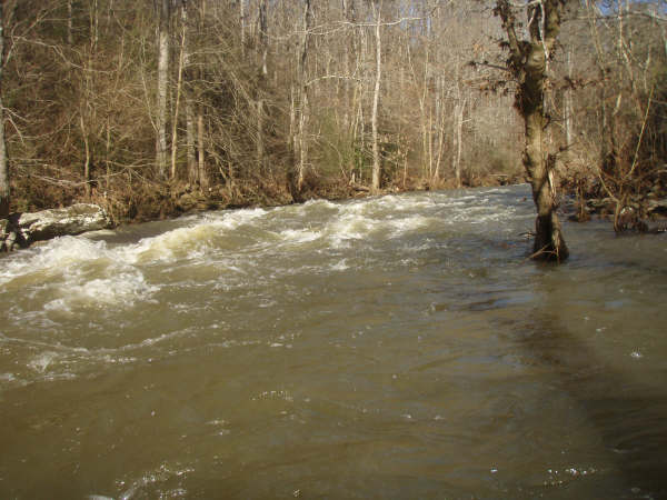
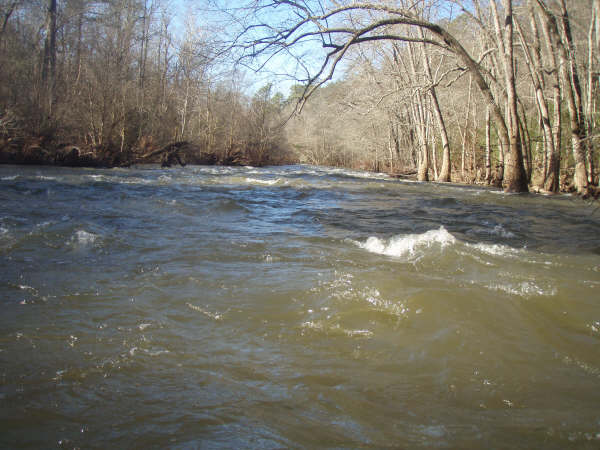
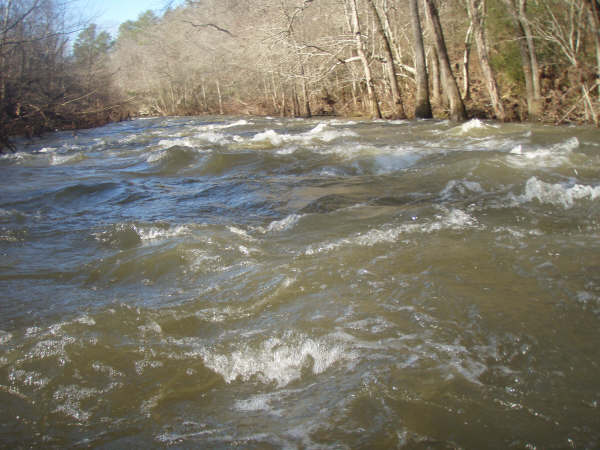
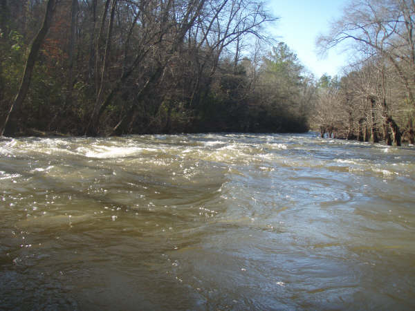
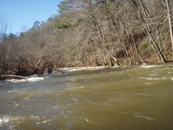
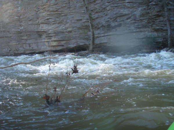
If Hwy 67 to 278 is the upper upper, and CR10 to old Hwy 31 is the upper, what is this long stretch between them from Hwy 278 to CR10? The upper 1.5? I don't know, but I've been really lazy about listing it in the guide. It has some rapids, and some long flat parts as well. Except for a couple short bits at high water following feed creek runs, I've never paddled this part of the Mulberry. Most people that I know that have run it have done the first 6 miles or so from 278 to CR51. Intermediate access points include CR55, CR51, and CR747/47.
Ben Styles offers the following: My wife and I took our 14 ft. tandem open canoe on the "Upper, upper" run (the level was 6.25'). We decided that we had time to go past 278, so we went down to County Rd. 55. We didn't know whether to expect - boring flatwater or a continuation of the consistent shoals/rapids of the "upper, upper." We were pleasantly surprised to discover that with the exception of a couple of 5-minute paddles, it was a good run. There were approximately 20 shoals/rapids, with 3-4 being strong class twos with high waves (we had to dump the canoe out twice) at this water level. Today (Friday), we went from County 55 to County 51. While the level was much lower (4.8'), we still had a good run with little flatwater and few rocks. A couple of rapids would have swamped us for sure at Monday's level.
While the "Upper, Upper" is still our favorite, at least the first 6 miles below 278 is nice for intermediate level canoeists like us for whom the class threes of the Locust are about the max (we survived it).
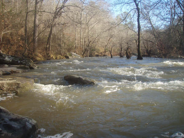
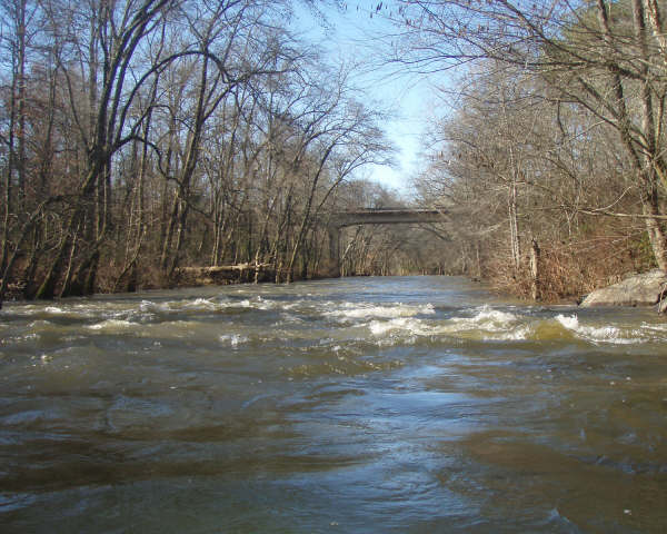
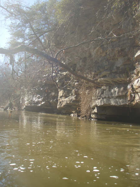
From Ryan Stephens: The run from 278 to 51 is a true whitewater run class I-II and did not have excessive flatwater at all. The section that starts at 51 and goes to CR10 is all flatwater - the kind of flatwater that is pooled up and has the consistancy of syrup, except for two nice class II rapids at the "shrine."
The newly installed StreamBeam Mulberry gauge is on the same bridge as the old visual gauge and is set to read at the same level. Look for a level of 1.5'+ to run this section.
Details
-
ClassI (II)
-
Gradient (fpm)~8'/mile
-
Length (mi)22.4 miles
-
Watershed Size (mi2)67.3
-
Put InHwy 278 (or various)
-
Take OutCR10 (or various)
-
ShuttleHwy 278 / Hwy 231 / CR26/ CR10
-
Water Quality
 (
2 chickens | 1 = Good, 3 = Gross)
(
2 chickens | 1 = Good, 3 = Gross)
-
Primary Gage
- StreamBeam Mulberry 1.5'
-
Indicator Gage
-
Precip. Gage
Map
Video
Photos
Trip Reports
Mulberry Fork, Hwy 278 to CR 10
Written by Ryan Stephens
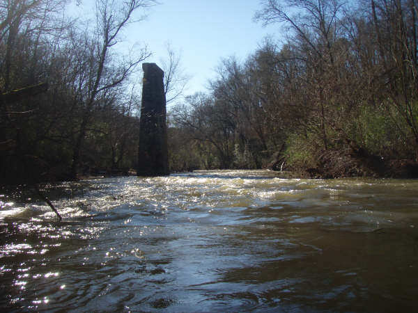
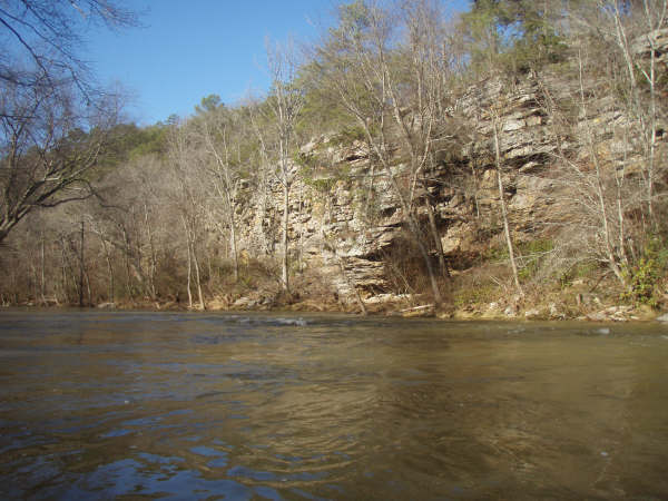
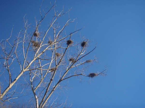
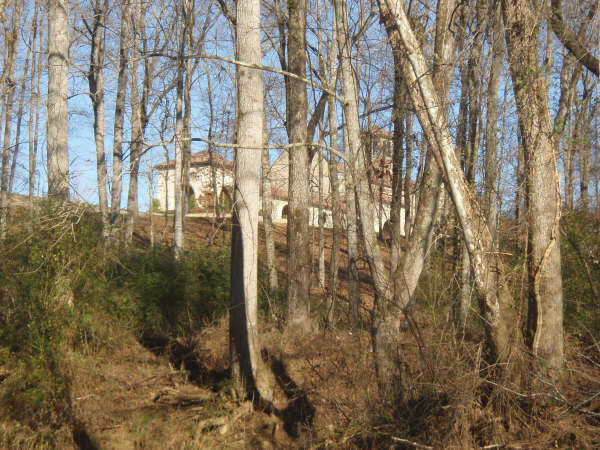
I have been meaning to paddle the upper stretches since I moved up this way. Yesterday we bagged the upper upper and today I decided to paddle from 278 to my house (couple miles below CR10) I packed a lunch extra gatorade and a flashlight. First let me say that both the upper upper and the next run 278 down to 51 are great runs. The upper upper was not too intimidating class II but had a real creeky feel (garden city at 4ft) and 278 to 51 was a great I-II creeky run (Garden city at 3ft). Both were very scenic. I saw all kinds of critters (wood ducks, blue heron, possible green heron, kingfishers, a hawk, some turtles, a buzzard, and found a tree full of Osprey nests (I think I may have saw one flying). But after 51 even though it started out with some rapids it quickly pooled up and became an epic flatwater paddle, still scenic but not nearly as much fun. I bet there is at least 6-8 miles of flatwater! I had pretty become resigned to the fact that I was going to be paddling in the dark. The best way I can describe this section is through this YouTube clip. I paddled furiously and finally had to rest and eat where there was sun and rock. While I was eating I heard the most beautiful sound...bells from across the way...church bells. I had been saved by Jesus, more specifically the "The Shrine of the Most Blessed Sacrament." At my darkest moment I was shown the light at the end of the tunnel. Once I paddled by the castle there were two sweet class II rapids that I will never paddle again unless the penguins let me put in at the castle. 3-4 miles later I was in my whirlpool tub in some hot mf water drinking some hot mf coffee. And it was only 3:30 pm I still had a couple of hours of daylight!