Swamp Creek Upper
-
RunSwamp Creek
-
ClassI-II (III)
-
Put InHwy 231
-
Take OutHwy 22
-
Length (mi)8 miles
-
Gradient (fpm)16.8'/mile, 1 mile@40'/mile
-
Watershed (mi2)27.4
-
Primary Gage
- None Visual
-
Indicator Gage
- Hatchet below Rockford 700 cfs, 1000+ better
Description
Upper Swamp (Hwy 231 to Hwy 22):
In my quest to learn more about Socapatoy and Weogufka Creeks, Brad Thompson told me about Swamp Creek from Hwy 22 to CR 29 (Lower Swamp). I checked it out. As I was scanning around the topos for the area, I happened to see the word 'Rapids' and some relatively close elevation lines on the section above Hwy 22. Intrigued, I checked out the aerial photos on the terraservice site. Sure enough, little trails of white could be observed. Brad said "the term micro would be an overstatement (usually dry?)" for this stretch and he figured logjams could be a major problem. Never that easily deterred, I put it on my to-do list.
Swamp is indeed an enjoyable class I-II run with a relatively short section of fun II+ and III at about mile 2.5 or so. As of early 2005, logjams are not an issue at all. It would be a fun family paddle in the summer just after a good rain. The creek is at its narrowest at the put-in and take-out, but has a fairly wide streambed for most of the run. The first mile is quite flat and silted, but slowly the rocks begin to emerge until the fun mile begins. There are one or two 5-6' high straight-on drops that would really make a tandem flatwater canoe run entertaining. The steepest part of the rapids swings from bank to bank with eddies and even a wave or two if the water is high enough. After a calm stretch, a dam forces the flow into a culvert, but the dam is very easily portaged on the right on only wastes about 5' of gradient. A double drop just downstream is fun. The rest of the run has many stretches of flatwater and the odd shoal. No pool is outrageously long, and with copious water, the current will move throughout. Upper Swamp could easily be combined with Lower Swamp for a very full day of Central Alabama boating.
The shuttle is painless, just go through Rockford. There is plenty of parking at the take-out, but the put-in is tight right next to the bridge.
Lower Swamp Creek (Hwy 22 to CR 29):
From Brad Thompson: Swamp creek, which flows into the terminal end of Hatchett is a fun whitewater run when flowing. You can put in along HWY 22, just northeast of county road 29. The take out is county road 29 steel bridge, the same as lower Hatchett. A rock garden when dry but lots of rapids in this short run when it's up.
by Tommy Steele from a trip in late February 2006:
Lower Swamp Creek @ 1800 falling on the Hatchet gauge:
This is a gem of a creek. There are small shoals around most bends in the creek, a lot like the Hatchet for the first couple of miles. The first rapids require maneuvering around a large tree trunk. 10-15 minutes in, the second set of rapids may be a fun and fast II. Many easily avoided strainers lay partially across the creek throughout the run. At the third series of shoals the creek comes very close to a bridge over Hwy 22. A small stream feeds into the Swamp here, and there are some nice rocks to stop on. Further down, the banks vary from steep and rocky to sloping. An island splits the creek after a few minutes; the left is scrapy, but the right has a neat series of waves. In the last mile or so the gradient seems to pick up. There are a couple of fun, continuous II/II+ sets of rapids with lots of rocks barely submerged and plenty of eddys. Lots of rocks to avoid but great at this level. After the second of these rapids the gradient disappears and the creek joins the Hatchet at the steel bridge on CR 29.
Details
-
ClassI-II (III)
-
Gradient (fpm)16.8'/mile, 1 mile@40'/mile
-
Length (mi)8 miles
-
Watershed Size (mi2)27.4
-
Put InHwy 231
-
Take OutHwy 22
-
Shuttle
-
Water Quality
 (
2 chickens | 1 = Good, 3 = Gross)
(
2 chickens | 1 = Good, 3 = Gross)
-
Primary Gage
- None Visual
-
Indicator Gage
- Hatchet below Rockford 700 cfs, 1000+ better
-
Precip. Gage
Map
Video
Photos
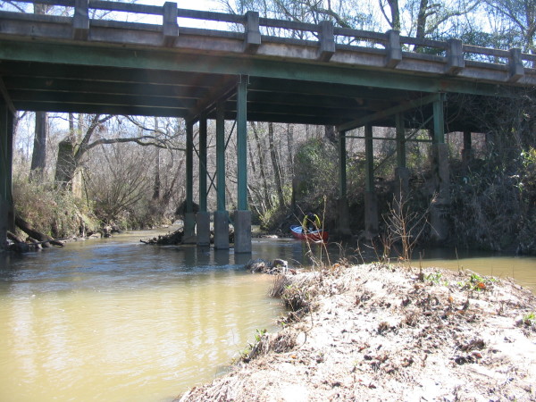
The put-in. I would not want to run it any lower than this.
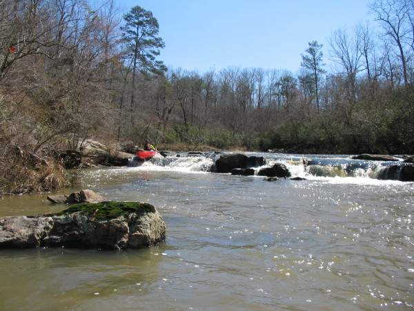
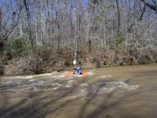
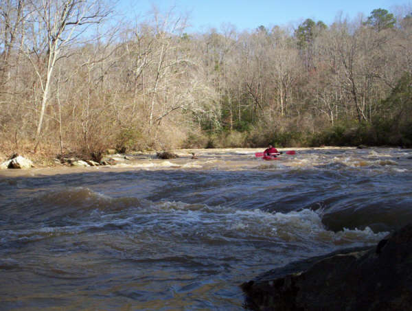
The first signs of gradient
This island spreads out the water, incurring hull wear
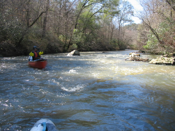
It starts to get better. I couldn't convince Dave to stop long enough to get his big red butt in the picture here.
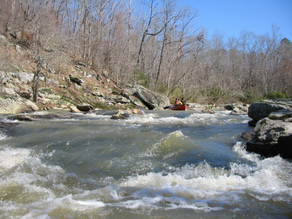
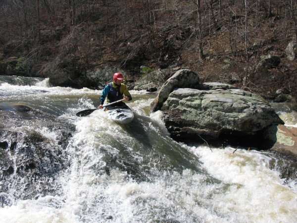
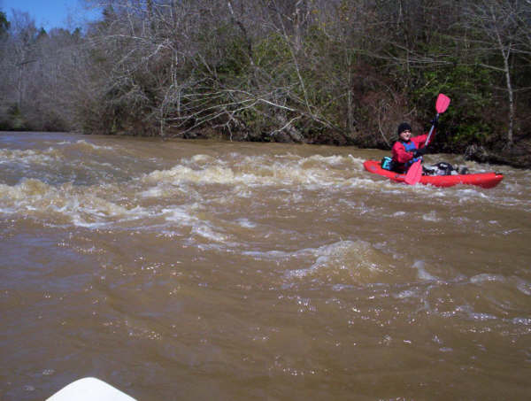
At the top of the good stuff
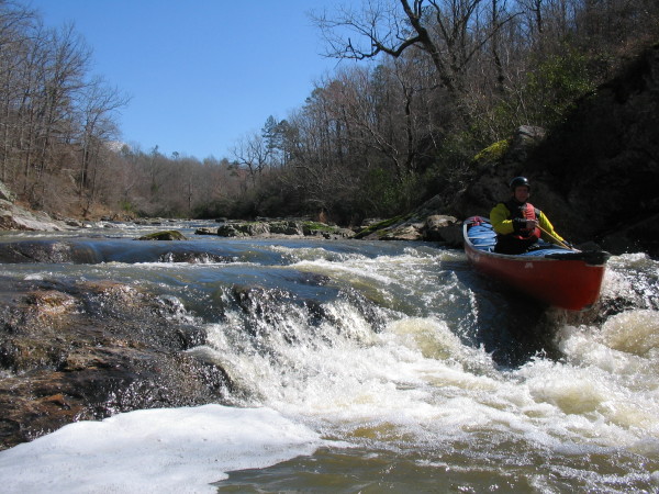
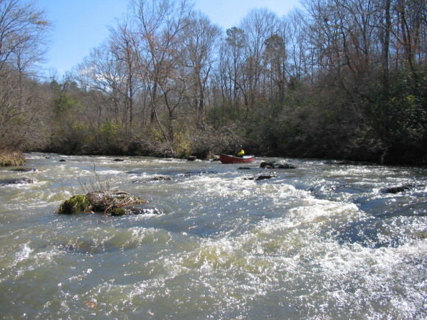
More good stuff
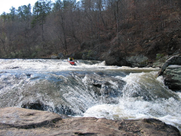
The biggest drop in the long rapids section
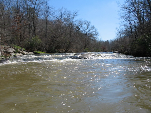
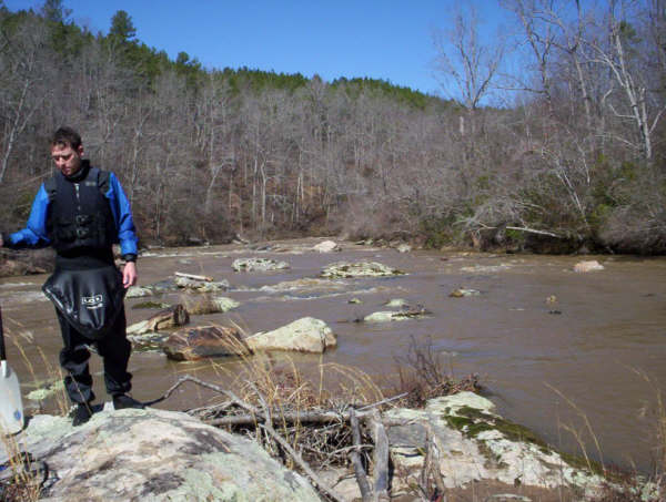
Need more water
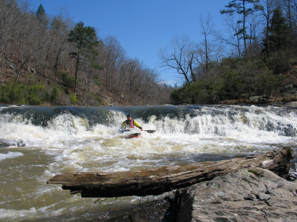
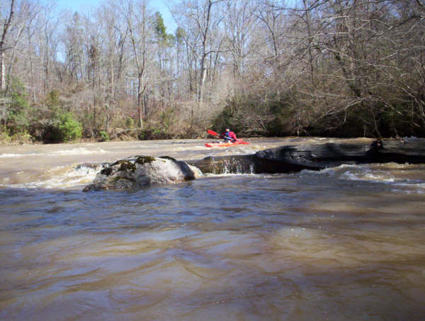
The first drop below the dam (in the background), directly above the...
Second drop below the dam. A few more miles of shoals and flatewater are below this point.

Trip Reports
Socapatoy and Swamp Creeks
March 1, 2005
Written by Dave Curry
David Curry (OC-1), Mark D’Agostino (C-1)
We had a pretty good rain Sunday night and Monday morning. Mark called me on Monday afternoon with instructions to pack my gear for a crack-of-dawn departure on Tuesday. The destination: fresh-meat runs on a pair of creeks in the Sylacauga area. I was directed to load the Whitesell so I wouldn’t chicken out if the rapids got tough. When he showed up at my house at 6:30AM with a Cascade and not the new Nomad in the back of his truck I knew we were in for unknown and possibly dicey waters.
By 9:30AM we were looking over the side of a bridge on Highway 22; the Swamp Creek takeout. The creek was small and the flow looked low, but adequate. After a quick change into our dry suits (which would not come off for over 6 hours) and a short shuttle, we were paddling on flat water. According to Mark, from his studies of satellite imagery, there was supposed to be a couple of miles of whitewater in the middle of the 9 mile run. He assured me that it was whitewater and not just piles of white scum from hog farms. After the first mile, we began to get a few Class I riffles. A bit further downstream, the sandstone rocks gave way to granite and the rapids got a bit better including a couple of drops of about 4 feet. A short stretch of flat-water ended with a dam that required a short portage. Below the dam were a steep slide with a drop at the end and a good stretch of decent Class II rapids. We thought the creek would end up with about 5 miles of flat water. Luckily, Mark had overestimated the length of the run and it turned out to be only 3 miles.
By 1:30PM we were on the road running shuttle and heading for the second run of the day: Socapatoy. There was no time to stop for lunch. We had to eat on the move. The shuttle was fairly long and required about a five mile drive on dirt roads; so much for my freshly washed car.
According to Mark, Socapatoy has about a mile of whitewater in the middle of a 4 mile run. The creek was running swiftly and the flow seemed adequate so we jumped on and headed into the unknown. Sure enough, a little over a mile into the run, we began to encounter Class I-II rapids. Just like Swamp, the rocks changed from sandstone to granite, with some huge boulders in the stream. After a couple of good Class III slides, we came around a bend to view a distinct horizon line and some big boulders almost completely blocking the stream. I skirted a big rock, caught an eddy on river right, and climbed out of my boat to get a good look at what was downstream. What I saw made me glad I was paddling my “Big Red Security Blanket,” the Whitesell. The rapid started with a big curving slide into a generous pool; below that was a giant boulder garden that seemed to go on forever. After a brief discussion on the entry to the slide, Mark readied the camera and I took the plunge. The slide was actually easier than it looked, and I remembered to pull my elbows in as I rocketed past the boulder at the bottom. I climbed out and got some pictures of Mark’s run. The boulder garden turned out to be a fairly easy eddy-hop with a bit of “bump-and-scrape” along the way. More stream-flow would have made it a bit easier. After a few more shoals and some flat water, we were at the confluence with Hatchet creek and the final mile of swift moving flat water.
After a speedy shuttle and a 3 hour drive we were home by 8:00PM.
Both creeks were fun paddles. Our day would have been a lot more interesting if there had been more water. The level on Hatchet creek (the closest USGS gauge) was about 900 CFS. I think 1500-2000 CFS would have made things better.