Hog Creek
-
RunHog Creek
-
ClassIII+
-
Put InFairview Rd or Pleasant Grove Rd (?)
-
Take OutSpring Creek
-
Length (mi)3.3
-
Gradient (fpm)80, 100, 20
-
Watershed (mi2)8.8
-
Primary Gage
- None Visual
-
Indicator Gage
- Town near Geraldine 1000
- Locust at Cleveland 1000
Description
Forgive me if my recollections and resulting description of Hog Creek are somewhat bi-polar. I've only run it twice, separated by over eight years, a transition from open to decked boating, much on-water experience, and a huge disparity in water level. I had formerly dismissed Hog as a novelty due to major access hardships at the take-out. These still exist, but when the water is up, this run can be pleasantly spicy.
Hog is located at the southern end of Sand Mountain, just down AL79 from Guntersville. It has pretty decent gradient and some good III and III+ rapids at normal water levels. At high water, the creek rocks. Everything's is fairly easily scouted if required. Hog is very scenic due to the presence of many Gum trees on the creek edge and cliffs that line the creek on either side for the first 2/3 of the run. These cliffs have many waterfalls coming off of them, which are quite scenic. With lots of water, they even cause a significant wind to blow across the creek where they enter. There are two downsides to Hog, one minor, the other major. The minor one is the water quality. It is not good. Hank Sherrod tried to convince me it was four chickens on a three chicken scale (Graves is worse, BTW). The major issue is the end of the trip. You have to meander through flat water jungle, cross a couple low water bridges, and somehow find the take-out. We took out on Spring creek, and you may have to deal with logjams and lots of agricultural aroma and effluent. The best thing would be to find the landowner of the farm at the base of Hog and take out amongst the cows. We used a loop pull-off road that goes east off AL79 about 2 miles north of the creek cut. There is a church on the loop road.
The first half of the run was cleared of logs in 1996, so that means little now. We had to deal with a few at high water in 2004. There are probably many more that were underwater for us. Hog has a relatively narrow streambed that requires recent, but not too copious rain to get it going. Put in on one of the two forks that join just downstream of the road. The trip report is for our first run.
Details
-
ClassIII+
-
Gradient (fpm)80, 100, 20
-
Length (mi)3.3
-
Watershed Size (mi2)8.8
-
Put InFairview Rd or Pleasant Grove Rd (?)
-
Take OutSpring Creek
-
ShuttlePleasant/CR161-35/CR12/ CR64(Cox Gap)/SR79
-
Water Quality
 (
3 chickens | 1 = Good, 3 = Gross)
(
3 chickens | 1 = Good, 3 = Gross)
-
Primary Gage
- None Visual
-
Indicator Gage
- Town near Geraldine 1000
- Locust at Cleveland 1000
-
Precip. Gage
Map
Video
Photos
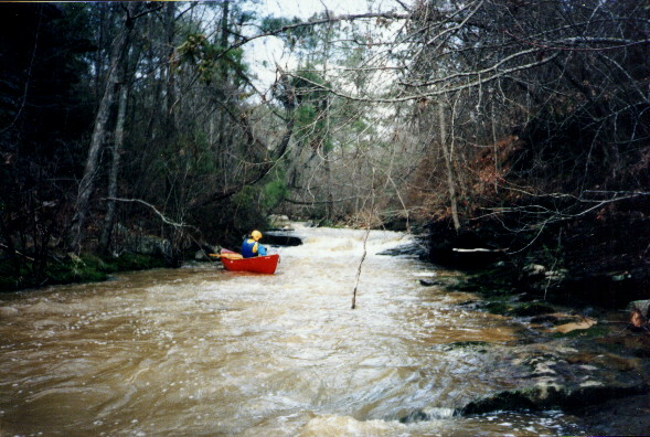
Mike Abernathy getting a shot of a rapid at the top of the run low water in 1996. This shot is only notable because the next picture...
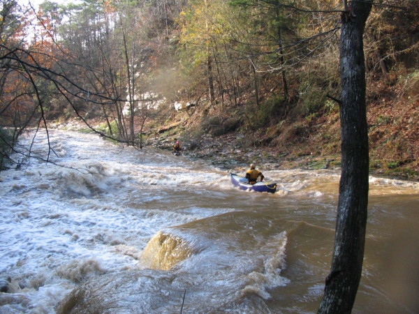
Shows the same rapid at a wee higher level in 2004. (beefy to near flood in 2004)
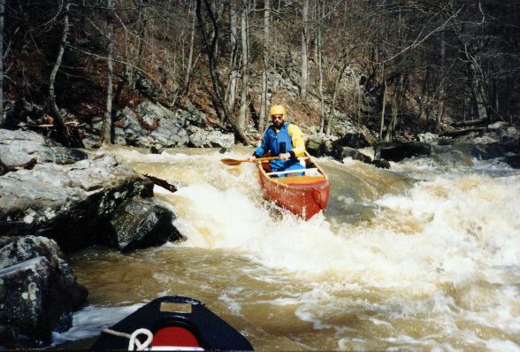
gMark D'Agostino on a little number we called Stun Line. (beefy to near flood in 2004)
A slide - Mike with John Parker in the distance. (beefy to near flood in 2004)
Dave Branham avoids the big breaker on a similar slide in 2004. (beefy to near flood in 2004)
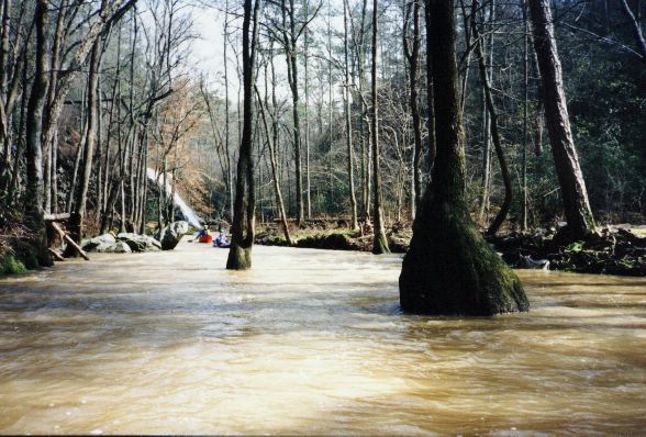
John Parker and Mike Abernathy among the gum trees. Not whitewater but darn scenic. (beefy to near flood in 2004)
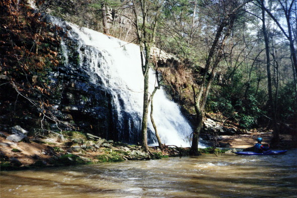
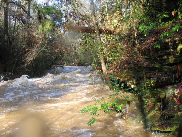
Hog has many very scenic waterfalls cascading over the cliffs that line the first 2/3 of the run. (beefy to near flood in 2004)
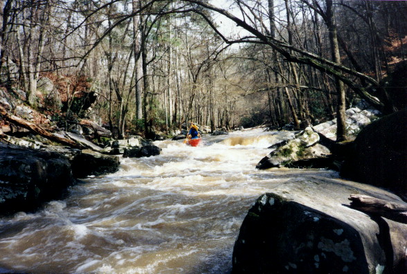
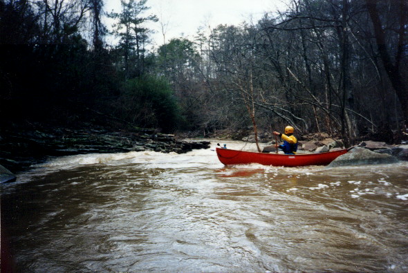
Mike on a rapid further into the run
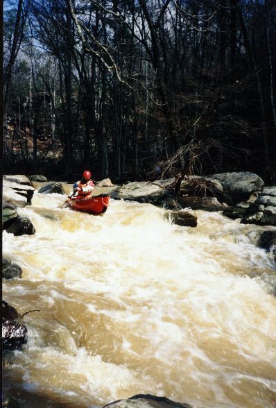
Mike Abernathy on Swine Flume (beefy to near flood in 2004)
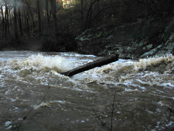
This log is the primary reason we walked the preceding rapid. (beefy to near flood in 2004)
Trip Reports
Hog Creek
Reprinted without permission from the April 1996 Huntsville Canoe Club Newsletter, "River Write"
Note: This was NOT a first descent. I met a lady whose husband ran it in 1972 in a Grumman canoe. She said it was "kinda rough."


