Little Uchee Creek
-
RunLittle Uchee Creek
-
ClassIII-IV
-
Put InCR 240
-
Take OutCR 179
-
Length (mi)1.24
-
Gradient (fpm)44' (1.24 miles)
-
Watershed (mi2)58.5
-
Primary Gage
- none visual
-
Indicator Gage
Description
The Little Uchee is in Lee Co. The creek is a fall line whitewater run with a few good rapids. The water quality is mediocre and muddy when it's running. To my knowledge we have no gauge. I used the Mulberry River in Georgia as a gauge. If it was really high we continued on to the Little Uchee. Unfortunately few boaters know of the Mulberry so it's of no aid. The access is on state road right of way. The first rapid "Satan's Garden" (at least that is what I think it was called) is a large river wide waterfall (known as Great Falls on the map). There are lots of possible routes. Some are more painful than others. The other rapid that sticks in mind was "Any which way you lose" and it was near the end. I recall some nasty pot holes in the drop. It's probably not that hard a run I haven't been down there since I moved to Clemson some years ago. I'd say class III maybe IV. by Will Reeves
History time: My brother in-law told me some of the history about this creek. The creek springs from the ground near SpringVilla. Until recently the spring produced 3 million gallons of water per day (~200cfs). It has been a local swimming hole for the community since anyone can remember. Last year the spring dried up. They don't know if this was caused by the drought or by the rock quarry they just started digging nearby. - Robert Martin 11/2000
**This is a short run that requires a big rain. 2500 on the Uchee is a reasonable guess, but the run is way upstream of Fort Mitchell and the flatwater delays the water a long time on its way to the gage. We ran it when it was peaking at about 1000, and we figured we needed 3 times the flow to make it sweet. If you can catch it just after the rain has ended, you are better off. The far right is pretty smooth on the big drop. That is a good place to judge water level since the creek is very wide there. If you have enough at the falls, the rest will be OK too. Watch for pins in any which way you lose.
Details
-
ClassIII-IV
-
Gradient (fpm)44' (1.24 miles)
-
Length (mi)1.24
-
Watershed Size (mi2)58.5
-
Put InCR 240
-
Take OutCR 179
-
ShuttleCR240/CR179
-
Water Quality
 (
2 chickens | 1 = Good, 3 = Gross)
(
2 chickens | 1 = Good, 3 = Gross)
-
Primary Gage
- none visual
-
Indicator Gage
-
Precip. Gage
Map
Video
Photos
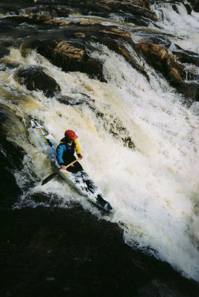
Satan's Garden or Great Falls. It goes even farther across the river. This is at low water on the far right.

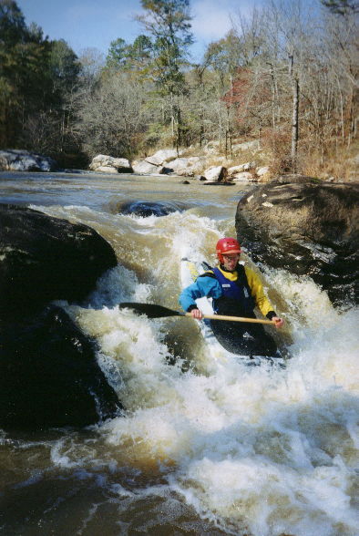
Kevin on the same.
Mark says: "Hey Kevin, you're right, there is a pinning rock down there (or something).
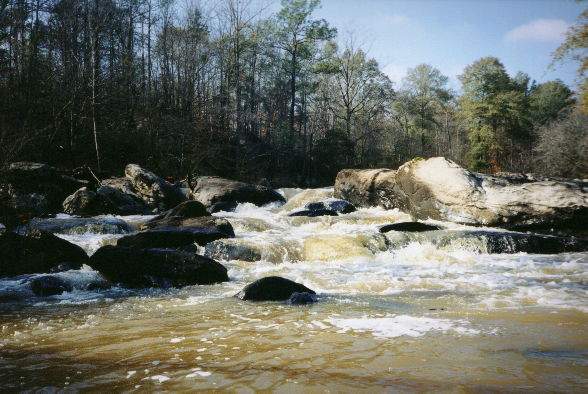
"Any which way you lose" from downstream.