Flat Rock/Coon Creek
-
RunFlat Rock/Coon Creek
-
ClassV
-
Put InRt. 117 (just N. of Rt 71, Flat Rock)
-
Take OutLake Guntersville Boat Ramp off Rt. 491
-
Length (mi)8+flatwater
-
Gradient (fpm)40, 60, 20, 120, 120, 260, 80, 20
-
Watershed (mi2)284
-
Primary Gage
- Put-in dam *see text Barely over the dam*
-
Indicator Gage
Description
March 2022 Update: the rapids on Flat Rock / Coon have changed significantly since the original description was written. At this point, the consensus is that the drops are now at least as hard, if not more difficult, than those on Jones Creek, and as such the run should be treated with an appropriate level of respect. An updated description will be provided once a sufficient amount of information is obtained.
Original run description:
Flat Rock/Coon is the 600 yard par 5 of Sand Mountain whitewater. Jones may have harder rapids (?), but it is not as long. There are those who can make this run with relative ease, but I've proven that I'm not one of them. Yes, inadvertent overnighters and multi-day expeditions are a possibility here. Can you say epic-friendly? I recommend a guide and a long day, or a really long day without a guide. If you must walk out, walk south, not north. North takes you through a very large abandoned strip mine.
Put in at the downstream bridge at the intersection of 117 and 71 on Flat Rock Creek. Flat Rock would be a fun IV (V) run if only you could take out at where Coon begins. The run starts out easy, with a few class IIIs and a fair portion of flatwater. The action picks up after awhile and is really a lot of fun for the class IV appreciative crowd. Then there is at least one solid class V and a couple IV and IV+s before the confluence with Coon. One drop features a hard to avoid undercut wall on river right. Another just above Coon treated the author and his C-1 to a most enjoyable pin. The last rapid above Coon has a cool 10-12' slot drop as its climax.
Then Coon begins when a tributary joins after five miles of Flat Rock. The next mile drops 260'. There is no shortage of class Vs here. If the water is up, you will now know it without a doubt. Some rapids are not short, and the portages are not easy. This is the part that bogs people down since they are already tired. If you make it past this stuff, you get to enjoy the 4+ mile lake paddle to the boat ramp.
Coon used to be infinite chicken water quality due to strip mining. In fact the first party to run it is reported to have thrown their equipment away after their run. But the situation seems much improved since the demise of the steam shovel on the Alabama landscape.
*This will run with a bit less water than Jones. There is a small dam just upstream of the put-in bridge. If the water is going over that real well, the run will be too high. An inch or two is getting high. Just a thin film of water over the dam would be about right. Jones should be around 11" or so.
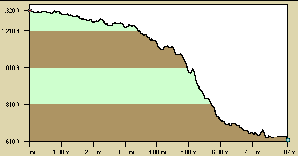
Below is a profile of the creek gradient. These data are not as accurate as the gradient field above but do give a graphical feel for how the gradient is distributed.
Details
-
ClassV
-
Gradient (fpm)40, 60, 20, 120, 120, 260, 80, 20
-
Length (mi)8+flatwater
-
Watershed Size (mi2)284
-
Put InRt. 117 (just N. of Rt 71, Flat Rock)
-
Take OutLake Guntersville Boat Ramp off Rt. 491
-
ShuttleRt. 117/ CR 491
-
Water Quality
 (
3 chickens | 1 = Good, 3 = Gross)
(
3 chickens | 1 = Good, 3 = Gross)
-
Primary Gage
- Put-in dam *see text Barely over the dam*
-
Indicator Gage
-
Precip. Gage
Map
Video
Photos
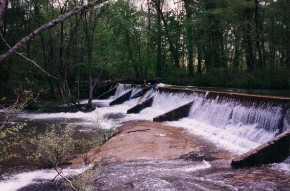
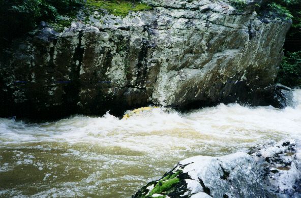
Ron runs the put-in dam. This is an important picture because it is a good way to judge level. The majority of the dam is just barely covered (...)
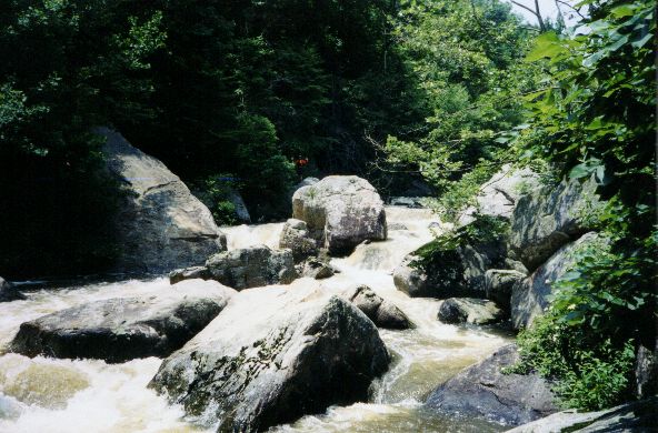
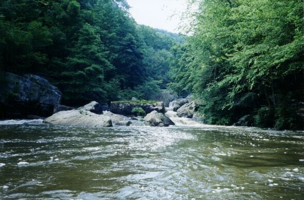
Dave Branham rounds a bend on Flat Rock. The water was fairly high on this trip.
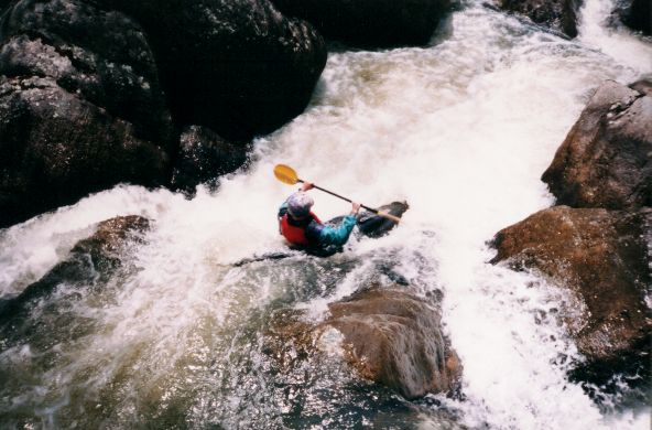
Ron runs a Flat Rock drop (photo courtesy Sloan Bryan)
Wade Amis does the undercut tango. All emerged unscathed.
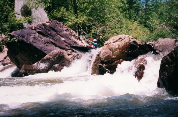
The upper part of the biggest Class V on Flat Rock.

Ron on what may be same rapid at a more reasonable level. (photo courtesy Sloan Bryan)
More of same (photo courtesy Sloan Bryan)
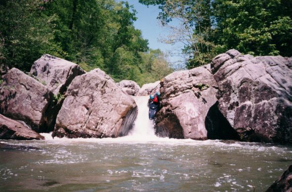
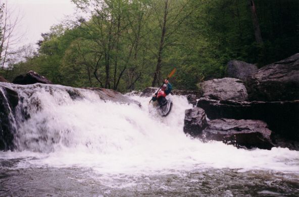
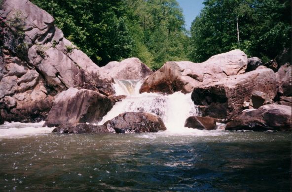
Ron runs the big slot at the end of Flat Rock. This was cool at higher water, I went deep enough to touch the bottom (photo courtesy Sloan Bryan)
The end of the last rapid on Flat Rock at high water. Things got ugly from here.
Ron Launches off a Coon drop (photo courtesy Sloan Bryan)
I remember this rapid on Coon. It was impressive as hell at high water. It took only a few seconds to realize that a walk was in order. (phot (...)

Ron enters the top of a complex big 'un (photo courtesy Sloan Bryan)

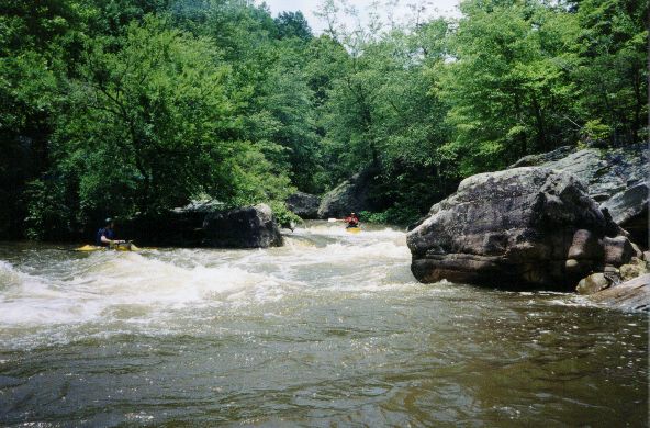
Sloan gets in tight with a boulder garden (photo courtesy Sloan Bryan)
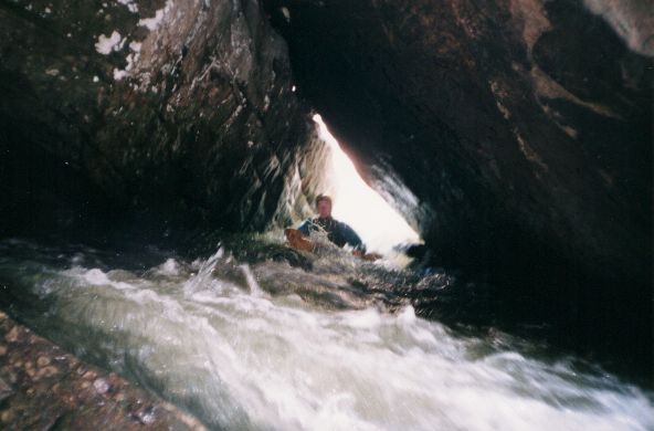
Sloan traverses the infamous Coon Creek 'cave rapid' (photo courtesy Sloan Bryan)